


Posted on Leave a comment

Ice Island Survives Run-In With Joe Island


AUGUST 24
AUGUST 23

A satellite view shows the iceberg after it pivoted out of the fjord into Nares Strait, wedged against a small, brown island.
NASA Earth Observatory / Lauren Dauphin

A satellite view shows a large tabular iceberg at the junction of its home fjord and Nares Strait.
NASA Earth Observatory / Lauren Dauphin

A satellite view shows the iceberg after it pivoted out of the fjord into Nares Strait, wedged against a small, brown island.
NASA Earth Observatory / Lauren Dauphin

A satellite view shows a large tabular iceberg at the junction of its home fjord and Nares Strait.
NASA Earth Observatory / Lauren Dauphin


AUGUST 24

AUGUST 23


An iceberg from Petermann Glacier encounters Joe Island in northwestern Greenland, visible in images captured by the OLI (Operational Land Imager) on Landsat 9 on August 23, 2026 (right), and August 24, 2026 (left). NASA Earth Observatory images by Lauren Dauphin.

Summer is prime iceberg season in Greenland’s glacier-fed fjords, and 2026 was no exception. Especially notable was the berg that broke from the Petermann Glacier along Greenland’s northwest coast in August. Roughly the size of St. Thomas in the U.S. Virgin Islands, it was the largest calving event by any Arctic glacier since 2020.

Iceberg calving is a routine part of an outlet glacier’s life cycle. Scientists watch the process closely, however, along with numerous other observations of the ice and its environment, for longer-term signs of instability. Petermann is one of Greenland’s largest marine-terminating glaciers and acts as a gatekeeper for ice flowing from the ice sheet into the ocean. Its future stability has implications for sea level rise.

The calving event of summer 2026 was spotted on August 4 by Adam Garbo, a doctoral student in glaciology at the University of Ottawa, in imagery from the European Space Agency’s Sentinel-1 mission. Garbo and an international team of colleagues have been using remote sensing to study and track the glacier’s ice tongue.

The team reported that the large tabular iceberg, or “ice island,” measured just over 76 square kilometers (29 square miles) at the time it calved—the largest to break from the glacier since the ice island of 2012 (130 square kilometers). The 2012 calving followed earlier major events in 2008 (31 square kilometers) and 2010 (just over 250 square kilometers).

The August 2026 event could have been even bigger. Garbo and colleagues had been expecting a major calving once one of the large rifts they were monitoring finally cut all the way across Petermann’s ice tongue. “What surprised us was that the calving instead followed a different fracture, producing a smaller ice island than we had originally anticipated,” Garbo said. As of late August, two large rifts remained and were expected to eventually produce new ice islands of roughly 94 square kilometers and 84 square kilometers, though the timing remained uncertain.

A detailed satellite view shows the iceberg wedged against the small, brown island, with sea ice packed densely to its left and more sparsely to its right.
August 24, 2026
NASA Earth Observatory/Lauren Dauphin

Glaciologist Mauri Pelto of Nichols College has also been tracking the iceberg, using images from NASA-USGS Landsat satellites, as it drifted down Petermann Fjord toward Nares Strait. In the week since it calved, the berg drifted an average of 3 kilometers per day. It continued toward the fjord’s junction with Nares Strait, where it rammed into a small rocky outcrop known as Joe Island (Joe Ø). The brief encounter is visible in images captured by the OLI (Operational Land Imager) on Landsat 9 on August 23 (top right) and August 24 (top left). A detailed view of the August 24 image is shown above.

Joe Island sits at the mouth of Petermann Fjord, making it one of the first obstacles a departing ice island meets. Collisions with it—like the one that split the 2010 ice island in two—often mark the start of a berg’s breakup. Petermann bergs tend to be thinner and more fragile than those calved by glaciers such as Greenland’s Jakobshavn and Helheim, and thinner still than Antarctica’s behemoths, Pelto noted.

“We were certainly watching closely as it interacted with Joe Island and were impressed that it survived the interaction without further fragmentation,” Garbo said.

The ice island was estimated to be less than 150 meters thick at the time of calving. Wind and surface currents have swept it out of the fjord, and satellite images show it pivoting away from Joe Island and continuing southwest through Nares Strait. As it drifts, it will fracture into smaller pieces as tides, winds, currents, and melting continue to weaken the ice.

Thicker bergs that calve from tidewater glaciers without floating ice-shelf extensions can drag and even become grounded on the seafloor within the fjord, while ice islands, like those from Petermann, might run aground later in their drift. Many ice islands have become “grounded” off the coasts of Coburg and Baffin islands.

Garbo and colleagues noted that ice islands and their fragments have been known to travel considerable distances, posing potential hazards to marine activities and infrastructure while also distributing freshwater through the ocean as they melt.

NASA Earth Observatory images by Lauren Dauphin, using Landsat data from the U.S. Geological Survey. Story by Kathryn Hansen.

References & Resources

You may also be interested in:

Stay up-to-date with the latest content from NASA as we explore the universe and discover more about our home planet.

Record-Setting Retreat of Hektoria Glacier

5 min read

Scientists relied on satellite data to understand how the Antarctic glacier lost so much ice so rapidly.

Article

Pasterze Hangs on as Austria’s Largest Glacier

4 min read

One narrowing icefall remains the linchpin for the Alpine glacier—and it may not be long for this world.

Article

An Uncommon Drifter in the Denmark Strait

4 min read

A large iceberg, observed in summer 2026, had drifted more than 1,000 kilometers south from the northeastern Greenland bay where…


Article

Source: science.nasa.gov
Posted on Leave a comment

Summer Triangle Corner: Deneb

3 min read

Summer Triangle Corner: Deneb

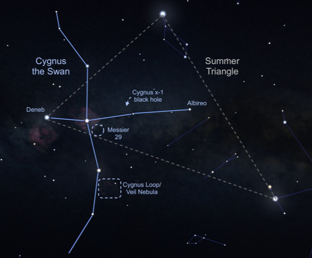
Artist's concept of the night sky showing the cygnus constellation, with a dotted line box surrounding the location of the cygnus loop
This image shows an illustration of the constellation Cygnus, Latin for “swan,” in the night sky. The Cygnus Loop supernova remnant, also known as the Veil Nebula, is located near one of the swan’s wings, outlined here in a rectangular box.
NASA

Bird constellations abound in the night sky, including Cygnus, the majestic swan. Easy to find with its dazzling stars, it is one of the few constellations that look like its namesake, and it is full of treasures. Visible in the Northern Hemisphere all summer long, there’s so much to see and even some things that can’t be seen. To locate Cygnus, start with the brightest star, Deneb, also the northeasternmost and dimmest star of the Summer Triangle. The Summer Triangle is made up of three bright stars from three different constellations – read more about it in the September 2022 issue of Night Sky Notes. “Deneb” is an Arabic word meaning the tail. Then travel into the triangle until you see the star Albireo, sometimes called the “beak star” in the center of the summer triangle. Stretching out perpendicular from this line are two stars that mark the crossbar, or the wings, and there are also faint stars that extend the swan’s wings.
 
From light-polluted skies, you may only see the brightest stars, sometimes called the Northern Cross. In a darker sky, the line of stars marking the neck of the swan travels along the band of the Milky Way. A pair of binoculars will resolve many stars along that path, including a sparkling open cluster of stars designated Messier 29, found just south of the swan’s torso star. This grouping of young stars may appear reddish due to nearby excited gas.
 
Let’s go deeper. While the bright beak star Albireo is easy to pick out, a telescope will let its true beauty shine! Like a jewel box in the sky, magnification shows a beautiful visual double star, with a vivid gold star and a brilliant blue star in the same field of view. There’s another marvel to be seen with a telescope or strong binoculars – the Cygnus Loop. Sometimes known as the Veil Nebula, you can find this supernova remnant (the gassy leftovers blown off of a large dying star) directly above the final two stars of the swan’s eastern wing. It will look like a faint ring of illuminated gas about three degrees across (six times the diameter of the Moon).

Illustration showing yellow, brown, orange, and red rapidly spinning disk with jets above and below it. Material is being drawn from an object on event horizon of the black hole.
The black hole named Cygnus X-1 formed when a large star caved in. This black hole pulls matter from the blue star beside it.
Image: NASA, CXC, Melissa Weiss (CXC)

Speaking of long-dead stars, astronomers have detected a high-energy X-ray source in Cygnus that we can’t see with our eyes or backyard telescopes, but that is detectable by NASA’s Chandra X-ray Observatory. Discovered in 1971 during a rocket flight, Cygnus X-1 is the first X-ray source to be widely accepted as a black hole. This black hole is the final stage of a giant star’s life, with a mass of about 20 Suns. Cygnus X-1 is spinning at a phenomenal rate – more than 800 times a second – while devouring a nearby star. Astronomically speaking, this black hole is in our neighborhood, 6,070 light years away. But it poses no threat to us, just offers a new way to study the universe.
 
Check out the beautiful bird in your sky this evening, and you will be delighted to add Cygnus to your go-to summer viewing list and visit NASA’s Black Hole Basics page to learn more!

Originally posted by Dave Prosper: May 2023
Last Updated by Kat Troche: July 2026

Source: science.nasa.gov

Posted on Leave a comment

APOD: 2026 September 7 – The Pelican Nebula in Gas, Dust, and Stars

APOD

Astronomy Picture of the Day

Discover the cosmos! Each day a different image or photograph of our fascinating universe is featured, along with a brief explanation written by a professional astronomer.

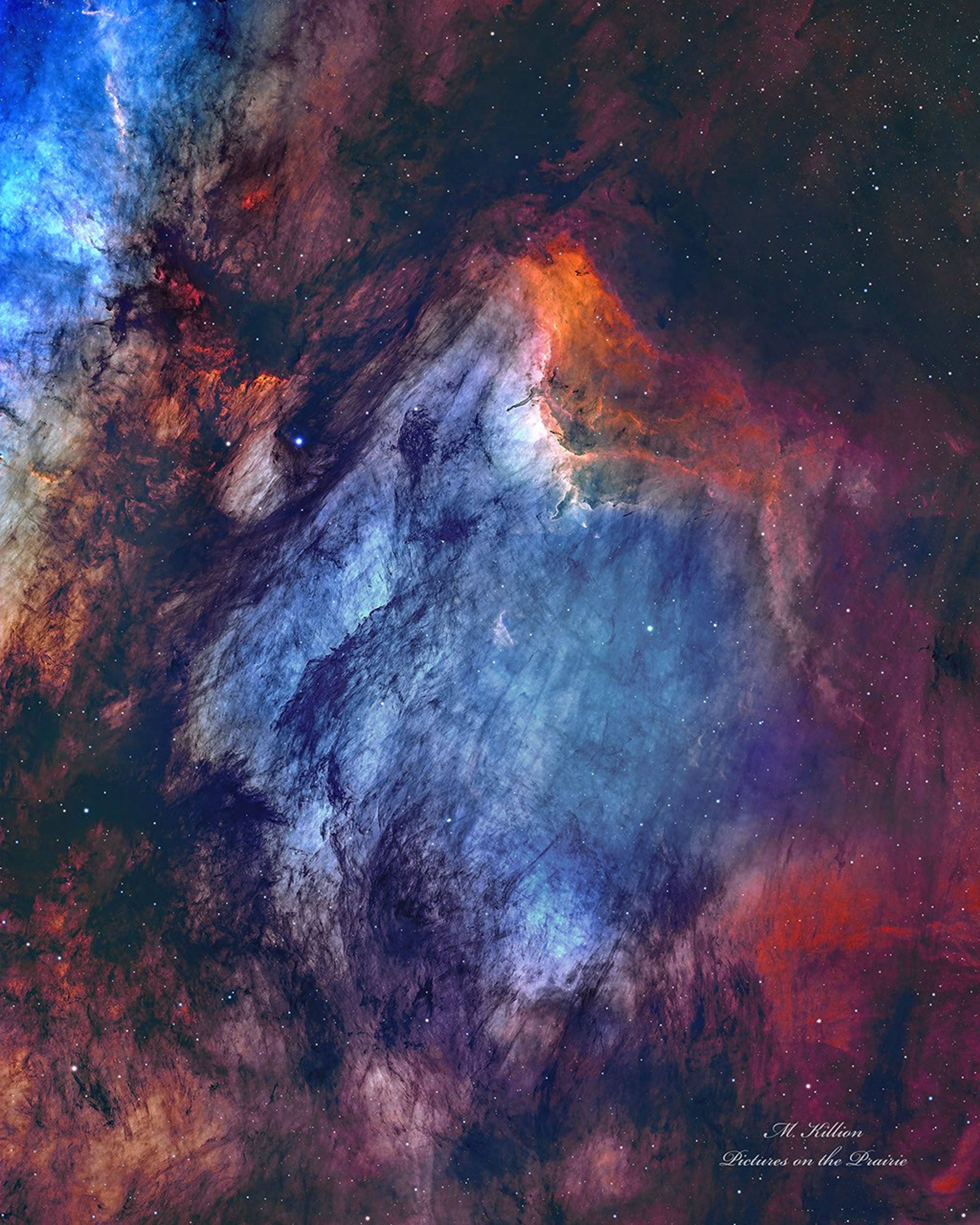
A busy starfield is dominated by red and blue glowing gas and dark filamentary dust. The nebula appears to some to have the shape of a pelican.

The Pelican Nebula in Gas, Dust, and Stars

Explanation: The Pelican Nebula is slowly being transformed. IC 5070 (an official designation) is divided from the larger North America Nebula by a molecular cloud filled with dark dust. The deep featured picture from UtahUSA incorporates 25 hours of exposure and brings out great details of this filamentary dust. The Pelican Nebula receives much study because it is a particularly active mix of star formation and evolving gas clouds. The light from young energetic stars is slowly transforming the cold gas to hot gas, with the advancing boundary between the two, known as an ionization front, visible in bright orange on the upper right. Particularly dense tentacles of cold gas remain. Millions of years from now, the Pelican Nebula, bounded by dark nebula LDN 935, might no longer be known as the Pelican, as the balance and placement of stars and gas will surely leave something that appears completely different.

APOD’s main site is moving: From apod.nasa.gov to science.nasa.gov/apod
Tomorrow’s picture: geometric Saturn

Date: September 7, 2026
Credit & Copyright: Mark Killion
Authors & editors: Robert Nemiroff, Jerry Bonnell, Cecilia Chirenti, Keighley Rockcliffe
A service of: ASD at NASA / GSFC,
NASA Science Activation & Michigan Tech. U.

Source: science.nasa.gov
Posted on Leave a comment

NASA Selects University Teams to Help Advance Aviation Research

4 min read

Preparations for Next Moonwalk Simulations Underway (and Underwater)

Aviation Research ULI Round 9 Awards wreath graphic.

NASA has selected four university teams to help the agency transform the future of aviation through projects ranging from high-supersonic propulsion systems to low-noise routes for small aircraft flying through cities.

The agency made awards through its University Leadership Initiative, which offers  student teams the opportunity to contribute to real-world flight research that advances NASA’s goals in aeronautics.

This year’s awardees are pursuing projects that align with NASA strategic objectives, including innovation in commercial high-speed aircraft, the development of new tools that can lead to transformational aviation breakthroughs, safer and more efficient air traffic management, and the integration of new air transportation options into the national airspace.

“With these four new awards, the University Innovation project is leaning in on NASA’s aeronautics mission priorities,” said Andrew Provenza, project manager, NASA’s Glenn Research Center in Cleveland. “These teams will research new propulsion concepts for supersonic flight, novel engineering methods that can revolutionize aerospace system design and certification, and learning-enabled avionics for new advanced and urban air mobility flight vehicle platforms, which could enhance air traffic control modernization.”

The awards represent the ninth round of NASA University Leadership Initiative funding. 

Totaling about $30 million, NASA’s awards will provide multiyear support for awardee universities to build their teams and conduct research. The initiative provides hands-on experiences for students, developing the U.S. aeronautics research workforce while also producing findings that will help drive aviation forward.

University Leadership Initiative awards go to teams comprised of graduate and undergraduate students and led by faculty members. Recipients form academic partnerships with other universities and community colleges, as well as industry. Experts from NASA, the Federal Aviation Administration, and other organizations provide support and guidance.

The awardees are:

University of Minnesota

Adaptive Supersonic Combined Cycle Engine for Next-generation Transportation

Led by Terrence Meyer, the project will work over four years to develop a fuel-flexible propulsion system that uses a traditional jet turbofan during takeoff and subsonic flight, but would transition to a new type of ramjet engine for supersonic flight. In ramjet mode, the system would cruise at Mach 4, or more than 3,000 mph. The project aims to enable efficient, faster-than-sound flight, including flight at high-supersonic speeds.

Stanford University

Safety Across Lifecycle of Learning-Enabled Avionics Systems: Safety Data Flywheel

Led by Somil Bansal, this four-year project aims to develop an avionics system to control an aircraft’s communications, navigation, and other electronics that incorporates machine learning. The system would take an approach that ensures safety is continuously reinforced throughout its operations. This research could help create a framework for the aviation sector to safely integrate artificial intelligence-enabled avionics into the national airspace.

Stanford University

Noise-Optimal Trajectory Planning for Urban Air Mobility Operations, Including Ambient Noise

Led by Juan Alonso, the center created through this award will work over four years to develop a high-fidelity simulation framework focused on developing low-noise flight paths in urban environments for future small aircraft. Developers are envisioning urban air mobility aircraft as ways to move people and cargo over populated areas. This center would integrate realistic models of how sound travels in cities to enable vehicle flight paths that would reduce community noise exposure from new air traffic.

Virginia Tech

Certification Driven Aircraft Design Under Uncertainty

Led by Darshan Sarojini, this three-year project proposes to transform next-generation aircraft design while integrating powerful new computer modeling tools: model-based systems engineering, multidisciplinary design, analysis and optimization, and high-dimensional uncertainty quantification. The goal is safe, faster, and more efficient modeling that results in fewer costly redesigns later in the aircraft development cycle.

For more than 10 years, NASA’s University Leadership Initiative has fostered bold ideas, collaborative research, and team-led solutions. The initiative is part of NASA’s Research and Technology Mission Directorate.

Source: www.nasa.gov
Posted on Leave a comment

NASA Student Aviation Challenge Focuses on Nation’s Infrastructure

3 min read

Preparations for Next Moonwalk Simulations Underway (and Underwater)

A photo collage showing drones and aeronautics structures for the Gateways to Blue Skies Challenge. The challenge name, InfraAir: Aviation for Infrastructure Inspection, is shown at the bottom.
Credit: National Institute of Aerospace

NASA’s next Gateways to Blue Skies competition invites collegiate teams to imagine innovative new ways aircraft could inspect land-based infrastructure, such as bridges and tunnels, to improve safety, reliability, and costs by 2035 or sooner.

Infrastructure is the foundation of the nation’s strong economy, global competitiveness, and daily quality of life. When that infrastructure is damaged or in disrepair, it restricts the movement of people, goods, and critical resources like water and energy. Inspections are important throughout the lifetime of infrastructure projects, but they often come with challenges.

Structures such as tunnels, bridges, highways, railways, and electric grids can be massive in size and difficult to reach. They can require disruptive shutdowns to access, or force workers to navigate extreme heights, confined spaces, and hazardous environments. As infrastructure ages and expands, there are opportunities to use innovative airborne platforms to improve current inspection practices.

“The demands for creative solutions like airborne platforms to improve the infrastructure sector are increasing exponentially,” said Steven Holz, Gateways to Blue Skies competition lead, NASA’s Langley Research Center in Hampton, Virginia. “The time is ripe for innovative students to transform how we work with our critical infrastructure, and this competition gives talented students the opportunity to do so.”

Sponsored by NASA’s University Innovation Project, the 2027 Gateways to Blue Skies competition encourages multidisciplinary teams of college students to conceptualize innovations in the world of aviation. Each year, the competition selects a new theme based on a complex challenge facing the Nation. It aims to engage as many students as possible from all backgrounds, majors, and collegiate levels.

The competition is open to teams of two to six students and divided into two phases. In Phase 1, teams will submit a proposal and an accompanying two-minute video, which will be judged by NASA and industry experts. Up to eight finalist teams will each receive a $9,000 prize and advance to Phase 2, where they will present their updated work to a panel of NASA and industry experts at a forum in May 2027. Winners will be offered the opportunity to intern with NASA Aeronautics in the academic year following the forum.

Teams interested in participating in the competition can review guidelines and eligibility requirements posted on the competition website. Teams are encouraged to submit a non-binding Notice of Intent by Monday, Oct. 12, via the website to stay apprised of competition news. Proposal and video submissions are due Feb. 22, 2027. The Gateway to Blue Skies Competition is run by the Aeronautics Division in NASA’s Research and Technology Mission Directorate. NASA’s Center of Excellence for Collaborative Innovation, part of the Prizes, Challenges, and Crowdsourcing Program within the Research and Technology Mission Directorate, manages the challenge contract. The National Institute of Aerospace administers the challenge on behalf of NASA.

Source: www.nasa.gov
Posted on Leave a comment

NASA Glenn’s Legacy Forged Through Decades of Flight Research

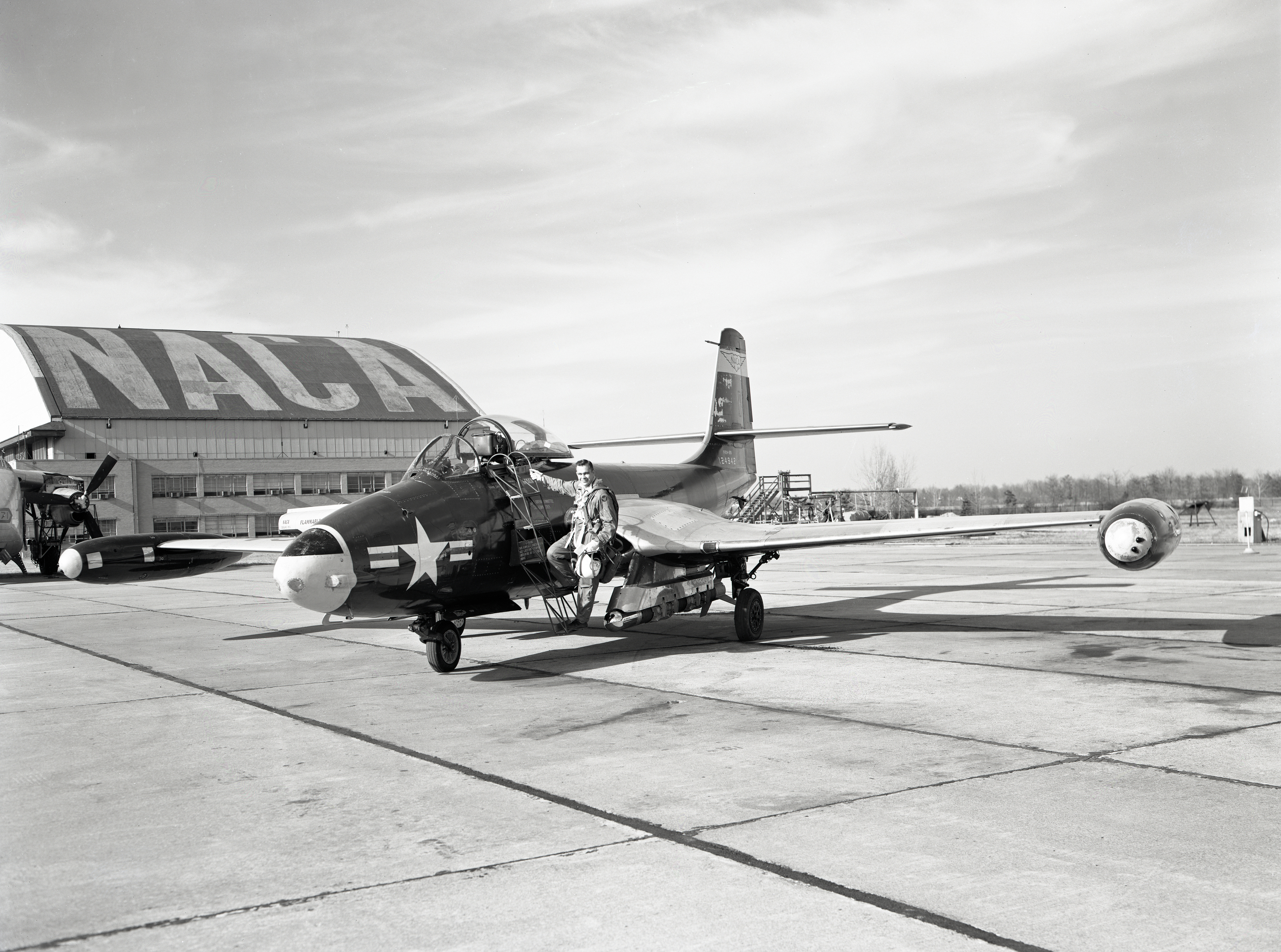
A pilot steps on a metal ladder to get onto a small, one-seater airplane. The NACA hangar is in background
William “Bill” Swann, one of the first-generation pilots at the National Advisory Committee for Aeronautics’ Flight Propulsion Research Laboratory (predecessor to NASA’s Glenn Research Center in Cleveland), prepares to board a McDonnell F2H-2B airplane on Nov. 6, 1956.
Credit: NASA

Many of NASA’s most important aerospace breakthroughs that began in the laboratory were ultimately proven in the sky. For decades, experts at NASA’s Glenn Research Center in Cleveland conducted flight tests — piloting aircraft into targeted environments such as icing clouds and carefully defined atmospheric routes. This approach allowed them to collect measurements directly in flight, providing critical data that linked laboratory theories to practical performance. 

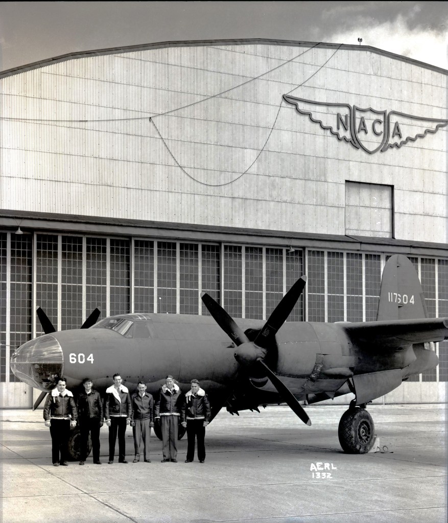
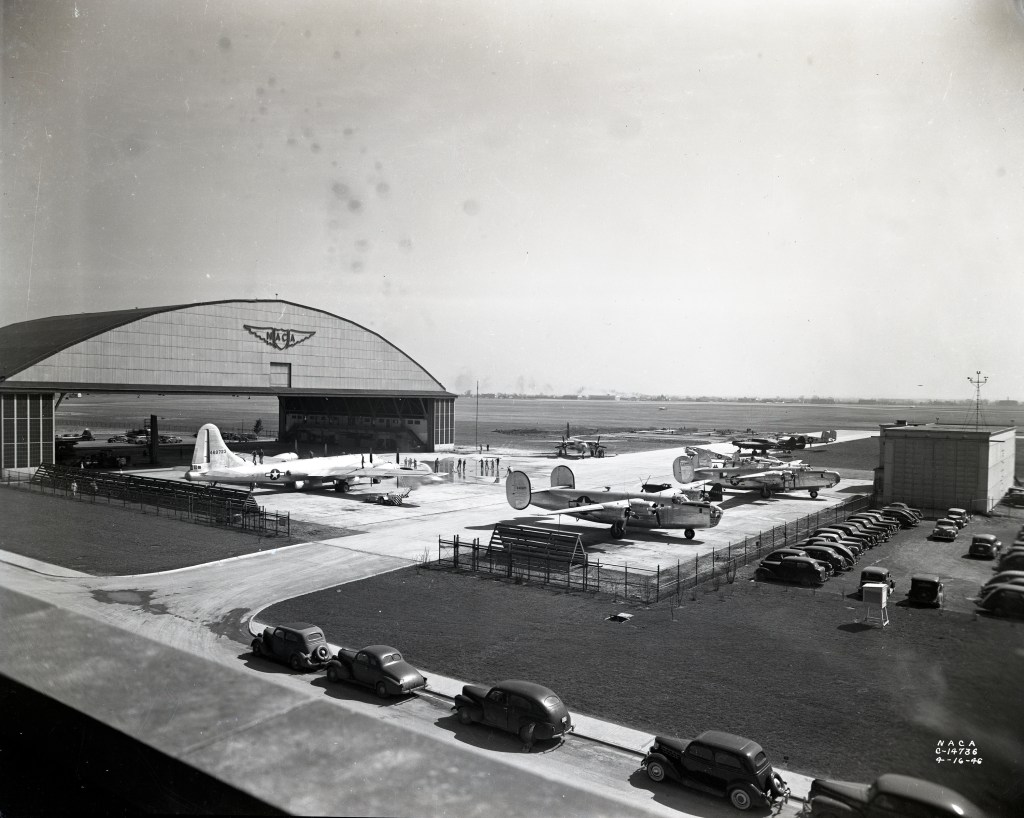
The center’s flight research dates to the 1940s, when NASA Glenn was known as the Aircraft Engine Research Laboratory for the National Advisory Committee for Aeronautics, NASA’s predecessor agency. During World War II, engineers and pilots worked to improve aircraft performance and increase high-altitude reliability. In the mid-to-late-1940s, flight research helped make early jet and ramjet engines practical. Later, Glenn’s flight programs helped improve the efficiency and environmental performance of aircraft engines — primarily conventional jet engines. 

Behind those early flight programs was a pioneering group of pilots who helped establish NASA Glenn’s reputation for airborne research. The center’s first generation of pilots, including Howard LillyJoseph Walker, William Swann, and William “Ed” Gough, helped lay the groundwork for more than two dozen other Glenn pilots, including future astronauts Neil A. Armstrong and Fred Haise

Together with Glenn’s researchers, engineers, and support staff, these pilots established airborne research capabilities that NASA continues to rely on today. Their work demonstrated how flight testing could bridge the gap between laboratory research and real-world performance. 

“These missions transformed aircraft into flying laboratories,” said Mark Russell, a NASA safety officer and pilot who served as the former acting chief of Aircraft Operations at Glenn. “They bridged the gap between ground testing and full-scale flight, proving the measurements needed to connect theory with performance. The testing also helped validate technologies and procedures later used aboard spacecraft and orbital missions.” 

Research workhorses 

From the start, NASA put its aircraft to work on a wide range of research challenges. 

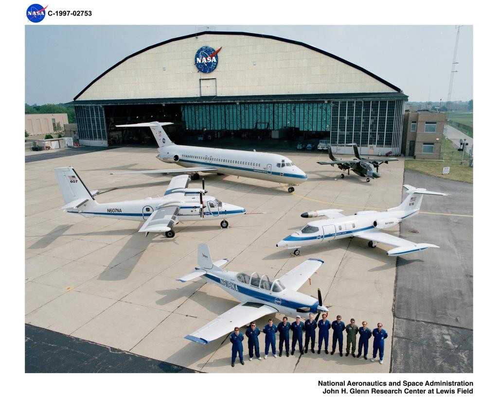
For decades, NASA Glenn aircraft have been used to study in-flight icing hazards, collecting data that has helped make commercial aviation safer. For nearly 40 years, NASA Glenn’s De Havilland DHC-6 Twin Otter served as the center’s workhorse for icing research, gathering data that helped shape modern aviation safety standards. 

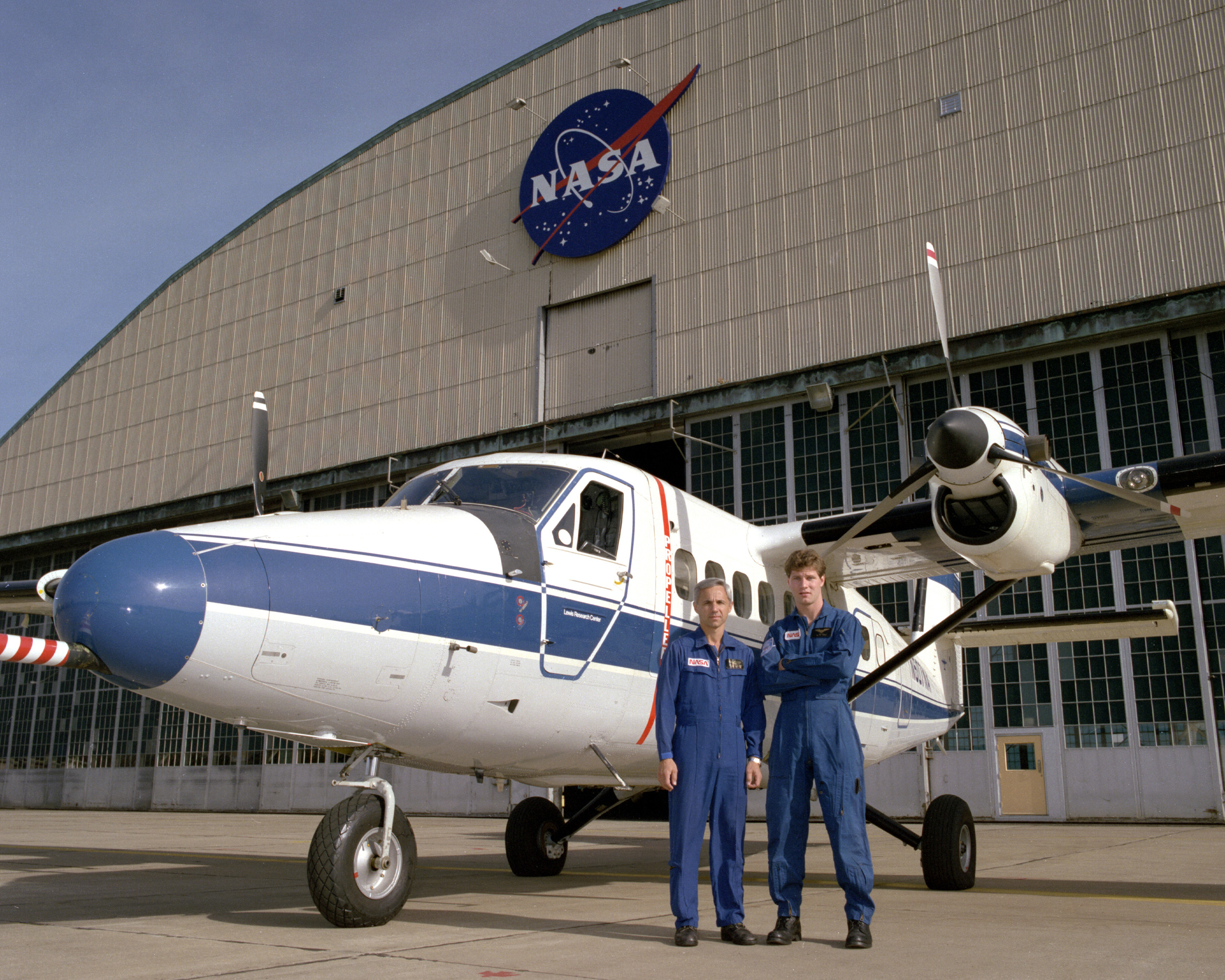
Two men in flight suits stand in front of a small aircraft painted white and blue. Behind it is an aircraft hangar with the NASA logo at the top.
Pilot Richard Ranaudo, left, and engineer Thomas Ratvasky with the De Havilland Twin Otter at NASA’s Glenn (then Lewis) Research Center in Cleveland on Feb. 23, 1993. The aircraft helped advance global aviation safety by defining the precise atmospheric physics of supercooled clouds and validating critical modern technologies used to predict, detect, and prevent in-flight icing hazards.
Credit: NASA/Tom Jares

Beyond improving aviation safety, Glenn’s flight research also explored new propulsion technologies that could transform the future of flight. Today, researchers are exploring hydrogen as an aviation fuel. But NASA Glenn helped show its potential viability decades ago using its Martin B-57B Canberra aircraft. After developing a hydrogen fuel system for the B-57B, a team tested it safely from February to April 1957. The flights showed the system’s reliable operation and advanced efficiency, marking a major milestone in aviation technology.  

Flight testing also supported technologies destined for use beyond Earth, helping researchers evaluate hardware under conditions that closely resembled space. Beginning in 1963, the center began a program to test and measure how well solar cells worked under conditions similar to those in space. Using specially modified airplanes, including Learjets, NASA conducted flights to help recreate some of the sunlight and atmospheric conditions that solar cells would experience outside Earth’s atmosphere. The program lasted decades, supporting space technology calibration through numerous high-altitude flights and adapting to newer aircraft over time. 

Researchers later applied these airborne capabilities to environmental science, extending their value beyond aviation and space technology. Using the Twin Otter and S-3B Viking over the Great Lakes, researchers tracked harmful algal blooms on Lake Erie by measuring changes in water color and composition. The data improved satellite systems used to monitor water quality and ecosystem health.  

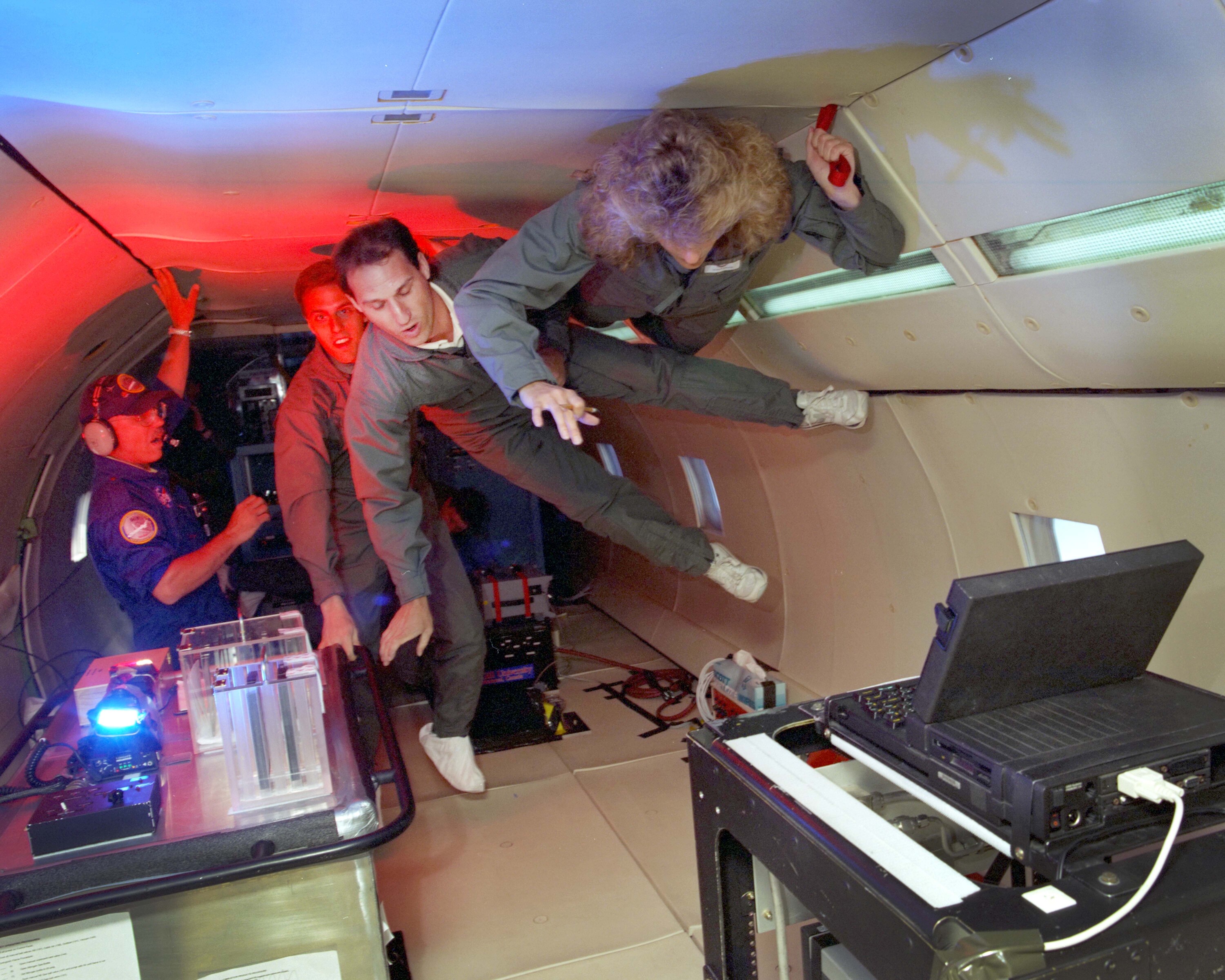
Glenn’s research aircraft also played an important role in preparing technologies and experiments for spaceflight through microgravity testing. NASA Glenn advanced microgravity research through in-flight testing using specially modified aircraft, such as its DC-9, to create short periods of weightlessness during parabolic maneuvers. These flights allowed researchers to study how fluids, combustion, materials, and experimental equipment behaved in near-zero gravity before experiments were conducted in space.  

Inside the bed of an aircraft with no seating, three people in gray flight suits hang onto the sides of the plane to gain balance in the microgravity atmosphere. To the left, a flight research staff member assists. Researchers make their way to two small tables that contain test hardware.
NASA’s Glenn (then Lewis) Research Center in Cleveland conducted microgravity research using the DC-9 airplane. Pictured, back to front, John Yaniec, Mike Mahn, Michael Capelety, and Susan Motil conduct microgravity research during a flight on July 10, 1996.
Credit: NASA/Quentin Schwinn

Recent breakthroughs 

Other significant accomplishments enabled by Glenn’s flight research include supporting the development and testing of sustainable aviation technologies, including research related to more fuel-efficient engines and sustainable aviation fuels, and advancing in-flight instrumentation and measurement techniques used across aeronautics research. 

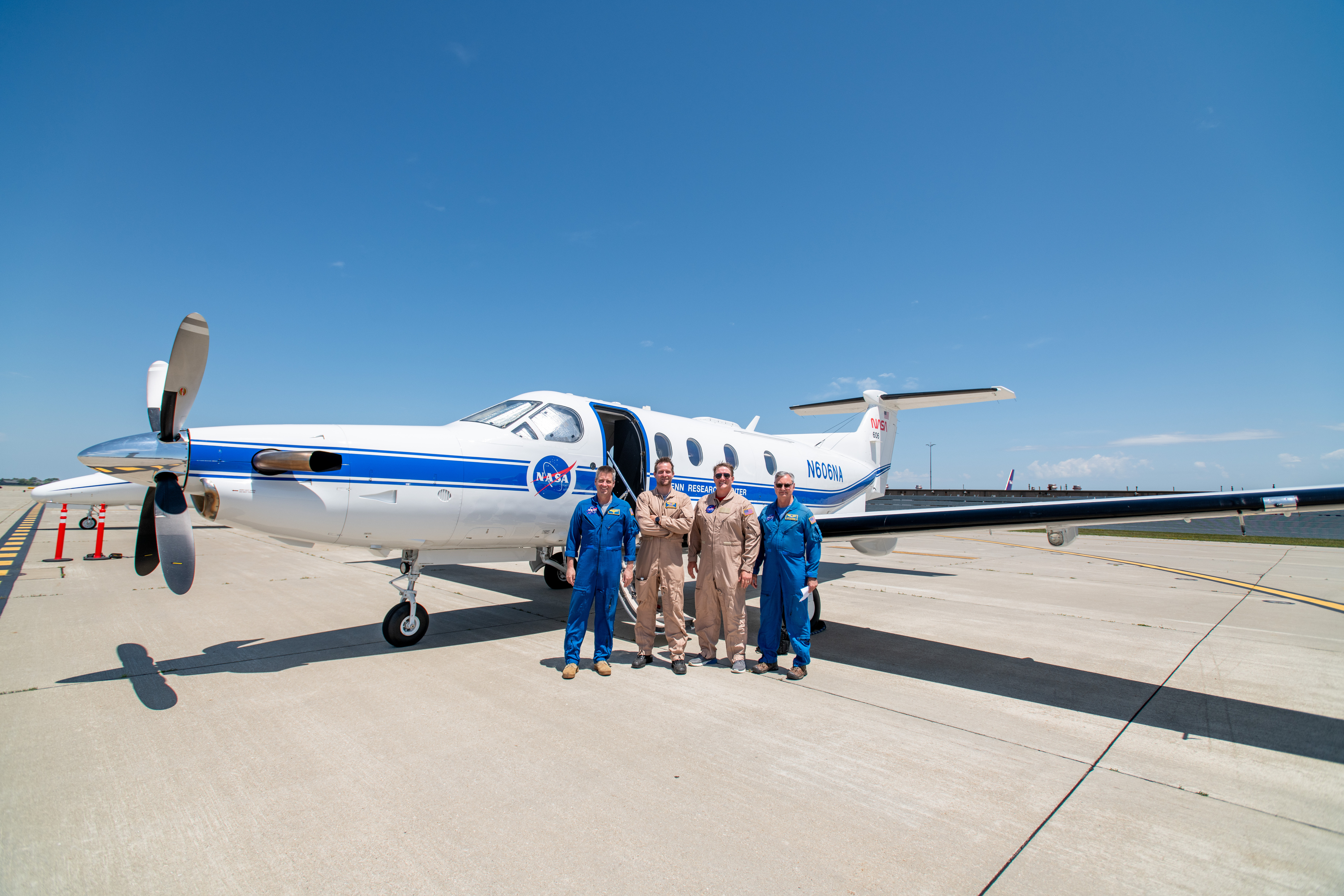
In 2024, Glenn’s Flight Operations participated in an optical communications study using the center’s Pilatus PC-12 NG aircraft. This mission successfully demonstrated the ability to transmit large volumes of data through a laser communication system across NASA’s legacy infrastructure. The work contributed to NASA’s broader effort to advance optical communications for future missions. NASA further tested optical communications on the Artemis II mission and effectively transmitted substantial amounts of data from the Orion capsule to multiple ground stations over the course of the 10-day journey.  

A team at NASA’s Glenn Research Center in Cleveland streamed 4K video footage from a Pilatus airplane to the International Space Station and back for the first time using optical, or laser, communications. Pictured on June 13, 2024, left to right, James Demers, Adam Wroblewski, Shaun McKeehan, and Kurt Blakenship.
Credit: NASA/Sara Lowthian-Hanna

As NASA’s flight research enterprise evolved, the agency also restructured how it manages its research aircraft. In October 2025, NASA streamlined its aircraft flight operations, relocating its aircraft from Glenn to NASA’s Armstrong Flight Research Center in Edwards, California. NASA Glenn continues its important icing and propulsion research and communications technology development in collaboration with Armstrong.  

From its historical roots in wartime engine development to modern work on aircraft safety, Glenn’s airborne research has consistently moved innovative ideas from the laboratory to real-world application. For more than eight decades, NASA Glenn has transformed ideas first proven in the laboratory into innovations validated in the sky — a legacy that continues to shape the future of aviation and space exploration. 

Source: www.nasa.gov
Posted on Leave a comment

NASA’s 737 Reveals New Paint

1 min read

Preparations for Next Moonwalk Simulations Underway (and Underwater)

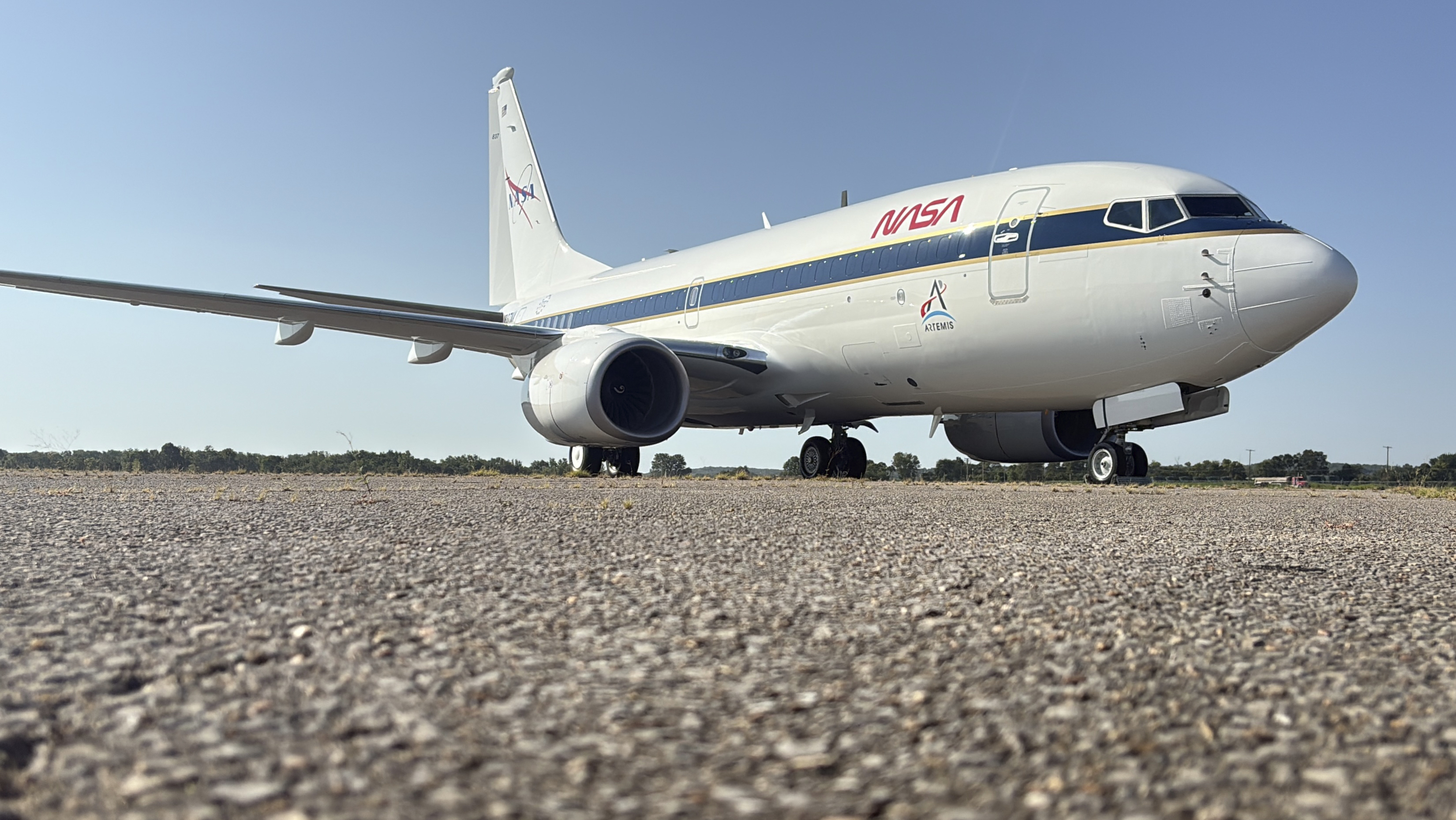
A large, white aircraft sits on a concrete surface after being painted with new NASA logos in red, white and blue.
A newly painted NASA 737 aircraft sits on a ramp in Oklahoma on Thursday, Aug. 13, 2026.
NASA/Carla Escamilla

NASA’s 737 aircraft was painted this week in Oklahoma as it progresses with modifications for use as a reduced gravity test aircraft for the agency. NASA’s Armstrong Flight Research Center in Edwards, California, took ownership of the aircraft from the United States Air Force in June. 

The aircraft will perform lunar-gravity parabolic flights to validate astronaut lunar suits and associated crew systems required to support Artemis mission objectives. These flights will happen at NASA’s Johnson Space Center in Houston for reduced-gravity operations, with NASA Armstrong oversight.

In addition, the aircraft will serve as a key asset for systems‑integration research for flight testing autonomy, sensors, and other digital systems.

Details

Last Updated

Aug 26, 2026

Editor
Dede Dinius
Contact
Teresa Whiting

Source: www.nasa.gov

Posted on Leave a comment

NASA Opens New Flight Dynamics Research Facility in Virginia

Image of NASA Langley's Flight Dynamics Research Facility
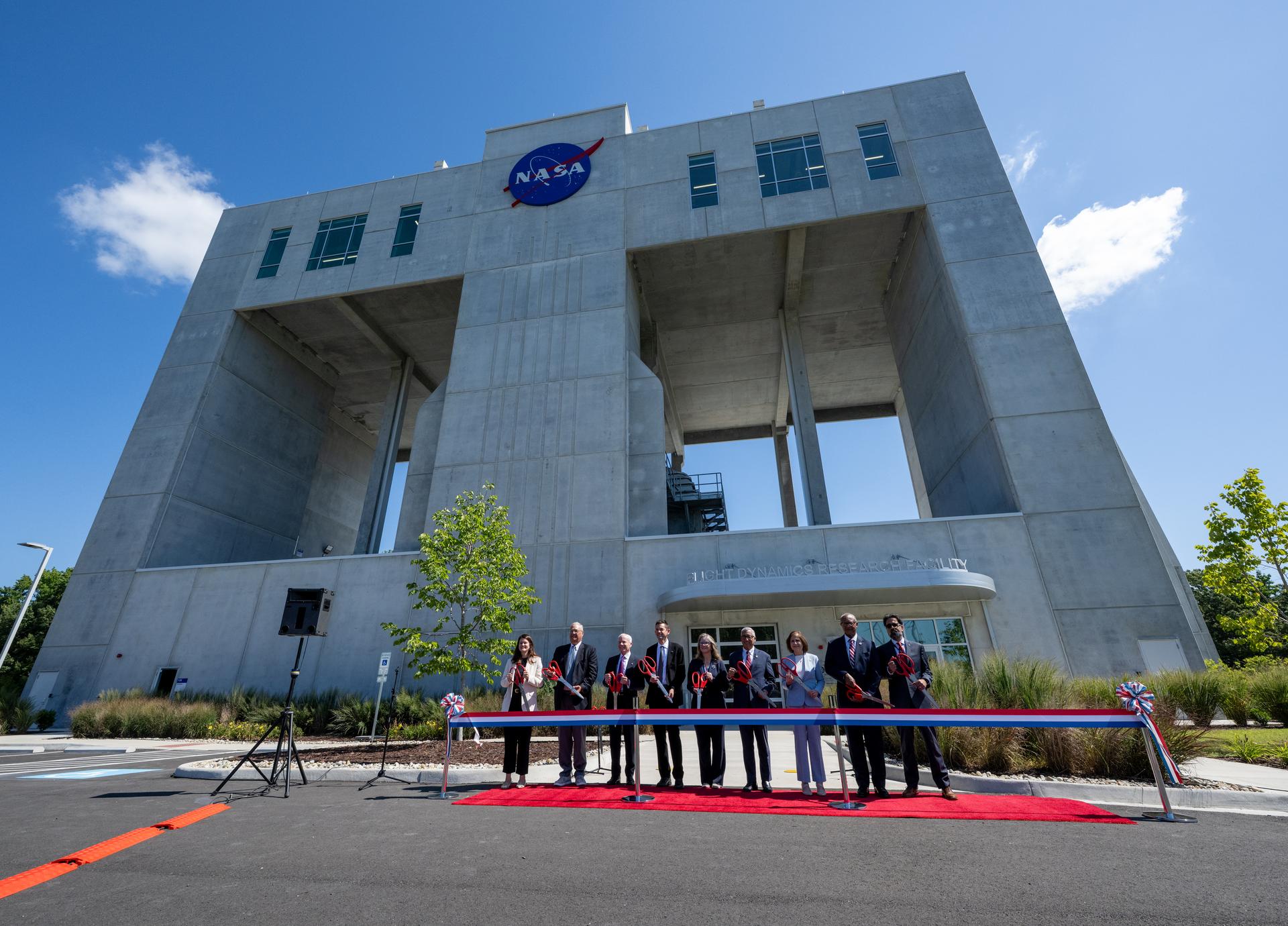
From left to right: Casey Swails, NASA deputy associate administrator; Mike Waller, vice president of BL Harbert International Federal Division; Edward C. Forst, administrator of the U.S. General Services Administration; NASA Administrator Jared Isaacman; Dr. Trina Dyal, director of NASA’s Langley Research Center; Rep. Robert “Bobby” Scott (D-Va.); Virginia Lt. Gov. Ghazala F. Hashmi; Jimmy Gray, mayor, City of Hampton; and Amit Kshatriya, NASA associate administrator, pose for a photo before cutting the ribbon to open the Flight Dynamics Research Facility, NASA’s newest wind tunnel, Friday, July 31, 2026, at NASA’s Langley Research Center in Hampton, Virginia.
Credit: NASA/Keegan Barber

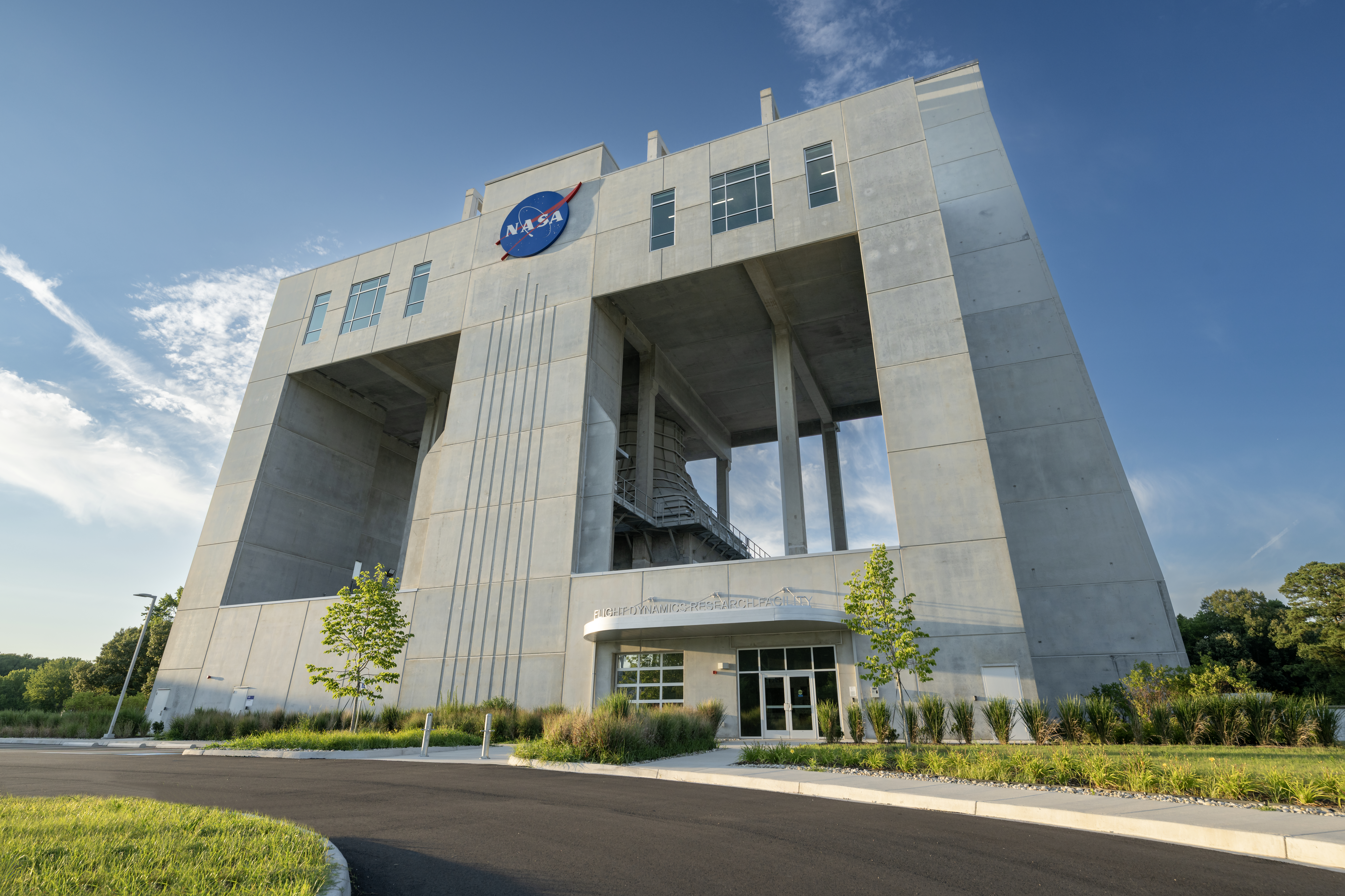
NASA opened its newest wind tunnel, the Flight Dynamics Research Facility, Friday, providing a critical resource for the agency and its partners to test the safety and performance of future generations of aircraft, rockets, and space exploration vehicles.

Located at NASA’s Langley Research Center in Hampton, Virginia, the Flight Dynamics Research Facility will support advances in aircraft safety, X‑plane development, drone research, and spacecraft technology. The facility will enable both free‑flight and mounted testing of a wide range of scale-model vehicles designed to travel through an atmosphere, from airplanes to space capsules returning to Earth.

“The Flight Dynamics Research Facility is NASA’s first major new wind tunnel in more than 40 years and gives us a powerful new platform to test the ideas and technologies that will shape the future of aviation and exploration,” said NASA Administrator Jared Isaacman. “America has led in air and space because we were willing to take on hard problems, challenge assumptions, and build what didn’t exist before. This facility gives the talented team at Langley, and our partners across government, industry, and universities, the tools to keep pushing the boundaries of what’s possible and ensure America remains the world leader in air and space.”

A ribbon-cutting ceremony at NASA Langley marked the start of a new chapter in flight research. Agency leaders, partners, and Virginia officials emphasized how the Flight Dynamics Research Facility’s state-of-the-art capabilities will shape the future of flight and exploration.

“The opening of the Flight Dynamics Research Facility represents a significant advancement for NASA and for the nation,” said Dr. Trina Dyal, NASA Langley center director. “By bringing modernized testing capabilities under one roof, we are enabling transformative research that will ensure the United States remains at the forefront of aeronautics and exploration.”

Built through a partnership with the U.S. General Services Administration (GSA), the facility replaces aging infrastructure with an energy-efficient facility that reduces maintenance costs and provides the flexibility needed for future research. The Flight Dynamics Research Facility is part of a broader, long-term collaboration between the agencies, representing the fourth new building GSA has delivered to NASA under Langley’s 20-year campus revitalization plan.

“GSA is proud to partner with NASA in delivering the Flight Dynamics Research Facility, a state-of-the-art asset that will power the next generation of American dominance in aeronautics and space exploration,” said Edward C. Forst, GSA administrator. “This facility reflects what we do best: provide the advanced, expertly designed installations that federal agencies need to carry out their missions. With these new capabilities, NASA will be better equipped to test bold ideas, validate new designs, and advance technologies that will serve the nation for decades to come.”

The Flight Dynamics Research Facility combines and improves upon the capabilities of two historic NASA Langley wind tunnels – the 20-Foot Vertical Spin Tunnel and the 12-Foot Low-Speed Tunnel. The 25,000-square-foot building features a vertical wind tunnel with improved airflow, modern digital systems, and flexible testing capabilities that will allow researchers to study how aircraft, spacecraft, parachutes, and other vehicles behave during flight.

The facility’s 20-foot diameter test chamber is much larger than those of its NASA Langley predecessors, allowing for more air to pass around test models and improving data accuracy. Its increased size also allows for the use of larger, more detailed models during testing.

The Flight Dynamics Research Facility’s top airspeed of 117 miles per hour is twice as fast as the old  facilities, enabling free-flight tests of heavier scale models. This will allow simulations of full-scale vehicles flying at higher altitudes – a critical capability for operations such as studying the stability of aircraft or reentry capsules coming back from space.

The facility’s wind power comes from four 750-horsepower motors, each with an integrated, 14-foot diameter, eight-bladed fan. The fan blades are made of lightweight carbon fiber, enabling rapid, precise airspeed adjustments during free‑flight tests.

The Flight Dynamics Research Facility illustrates the powerful synergy between NASA’s aeronautics and space exploration efforts, with each driving innovation in the other. The facility will drive experimental research across a wide range of flight systems, advancing the development of autonomous flight vehicles, drones, commercial and military aircraft, and X‑planes.

As NASA prepares for a sustained human presence on the lunar surface through the Artemis program and the development of a Moon Base, the facility will play a key role in testing vehicle designs for entry, descent, and landing that will help reduce mission risk and support the safe return of crews to Earth. NASA also will be able to use the wind tunnel  to help design aircraft for Mars and other destinations in our solar system where atmospheric flight is possible.

With the Flight Dynamics Research Facility now open, NASA is entering a new era in flight research – one that will shape the aircraft and spacecraft of tomorrow, strengthen industry partnerships, and extend the agency’s legacy of pioneering aerospace leadership.

The facility is managed under the Aerosciences Evaluation and Test Capabilities portfolio in the Aeronautics Division of NASA’s Research and Technology Mission Directorate.

Learn more about the Flight Dynamics Research Facility at:

https://go.nasa.gov/4yzKEGQ

-end-

Camille Gallo / Rob Margetta
Headquarters, Washington
202-358-1600
[email protected] / [email protected] 

Kimiko Booker / Brittny McGraw
NASA Langley, Hampton, Virginia
757-506-5939 / 757-769-3763
[email protected] / [email protected]

Source: www.nasa.gov

Posted on Leave a comment

NASA to Showcase Agency’s Newest Wind Tunnel in Virginia

Flight Dynamics Research Facility
The Flight Dynamics Research Facility, located at NASA’s Langley Research Center in Hampton, Virginia, is the agency’s first major wind tunnel built in more than 40 years.
NASA/Mark Knopp

Media are invited to NASA’s Langley Research Center in Hampton, Virginia, on Friday, July 31, to attend a media tour and ribbon-cutting ceremony for the Flight Dynamics Research Facility, the agency’s first new wind tunnel in more than 40 years.

The event will include a brief media availability with:

  • NASA Administrator Jared Isaacman
  • Dr. Trina Dyal, center director, NASA Langley
  • Administrator Edward C. Forst, U.S. General Services Administration

This event is in person only and open to members of the media who are United States citizens or lawful permanent residents. Information about timing will be shared closer to the event. NASA’s media accreditation policy is available online.

Media requesting to participate in person must RSVP no later than 5 p.m. EDT on Wednesday, July 29. Media RSVPs must be sent to Kimiko Booker, [email protected], and Brittny McGraw, [email protected], with the following information:

  • Legal first and last names (must match government identification)
  • Email
  • Phone number
  • Job title and organization

The wind tunnel opening marks a major milestone in the evolution of NASA and the nation’s aeronautics and space research capabilities. The state-of-the-art facility will support research and technology development that will advance NASA’s aeronautics, exploration, and science goals, including establishing a sustained human presence on the lunar surface through the Artemis program and the development of a Moon Base.

Learn more about the Flight Dynamics Research Facility at:

https://go.nasa.gov/4yzKEGQ

-end-

Camille Gallo / Rob Margetta
Headquarters, Washington
202-358-1600
[email protected] / [email protected] 

Kimiko Booker / Brittny McGraw
NASA Langley, Hampton, Va.
757-506-5939 / 757-769-3763
[email protected] / [email protected]

Details

Last Updated

Jul 22, 2026

Editor
Jennifer M. Dooren

Source: www.nasa.gov

Posted on Leave a comment

A Bright Spot at Mount Michael

A small ice- and snow-covered island with an active volcanic crater at its center is surrounded by drifting pieces of sea ice. A thermal signal and small plume appear in the crater, and ash darkens the snow on the volcano’s northern slopes.
Mount Michael on Saunders Island, seen in this image acquired with the OLI (Operational Land Imager) on Landsat 8 on August 24, 2026, hosts a frequently active lava lake in its summit crater.
NASA Earth Observatory/Michala Garrison

Winter near the Antarctic Circle brings months of frozen darkness, when sea ice chokes ocean waters and many of its denizens hunker down to ride out the harsh conditions. But as winter began to release its icy grip, an uncommonly clear satellite image revealed that part of this remote realm was still very much awake, at least volcanically speaking.

Mount Michael, the stratovolcano at the center of Saunders Island, rises above the ice-filled South Atlantic Ocean in this image, acquired with the OLI (Operational Land Imager) on the NASA-USGS Landsat 8 satellite on August 24, 2026. The natural-color image is overlaid with an infrared signal (OLI bands 7-6-5), shown in red, revealing heat from the persistent lava lake in its summit crater. A puff of a volcanic plume hovering over the peak, along with darkened snow on its northern slopes, also suggests ongoing activity.

Saunders Island is one of the South Sandwich Islands, a string of small volcanic peaks about 350 kilometers (220 miles) long that formed from the South American plate subducting beneath the tiny South Sandwich plate. Regular eruptions, including at Mount Michael, have occurred on these islands in recent centuries.

Because of the volcanoes’ remoteness, scientists rely on satellite data to understand their activity. An analysis of thermal anomalies in Landsat, Sentinel, and ASTER (Advanced Spaceborne Thermal Emission and Reflection Radiometer) observations spanning 30 years led researchers to conclude that Mount Michael hosts a persistent lava lake in its summit crater. Only a handful of other volcanoes on Earth, including Kīlauea, Nyamulagira, and Erta Ale, are known to have similar, frequently active features.

Thermal observations from the MODIS (Moderate Resolution Imaging Spectroradiometer) and VIIRS (Visible Infrared Imaging Radiometer Suite) instruments have also enabled long-term monitoring of Mount Michael. Data provided through MIROVA, a near-real-time volcanic hot spot detection system, indicate that low-intensity activity has been ongoing at the volcano for the past several years. Other observations from NASA’s Aura satellite show that emissions of sulfur dioxide and other gases are common at Mount Michael.

A series of V-shaped wave clouds appears over an ocean filled with pieces of sea ice.
Wave clouds form downwind of Saunders Island in this image acquired with the OLI (Operational Land Imager) on Landsat 9 on September 1, 2026.
NASA Earth Observatory/Michala Garrison

The cloud-free window over Mount Michael would close in short order. One week later, when Landsat 9 passed over the island, a more active atmosphere had returned. But the weather patterns interacted with the island to put on a spectacle of their own. The 843-meter-high (2,766-foot-high) peak jutting from the ocean disturbed passing winds to produce a series of wave clouds resembling the wake of a ship, a familiar phenomenon in this region. False-color imagery captured by NASA’s Aqua satellite indicates that a volcanic track caused by degassing sulfur dioxide was likely present as well.

NASA Earth Observatory images by Michala Garrison, using Landsat data from the U.S. Geological Survey. Story by Lindsey Doermann.

References & Resources

You may also be interested in:

Stay up-to-date with the latest content from NASA as we explore the universe and discover more about our home planet.

Ever Restless Mount Dukono Erupts

2 min read

The volcano on Indonesia’s Halmahera Island routinely ejects ash, volcanic gases, and volcanic bombs.

Article

A Sea of Spinning Clouds

3 min read

Icy, isolated Peter I Island stirred up a show in the atmosphere off the West Antarctic coast.

Article

America’s Emerald Isle

3 min read

Beaver Island is one in a string of verdant and scenic jewels in a northern Lake Michigan archipelago.

Article

Source: science.nasa.gov